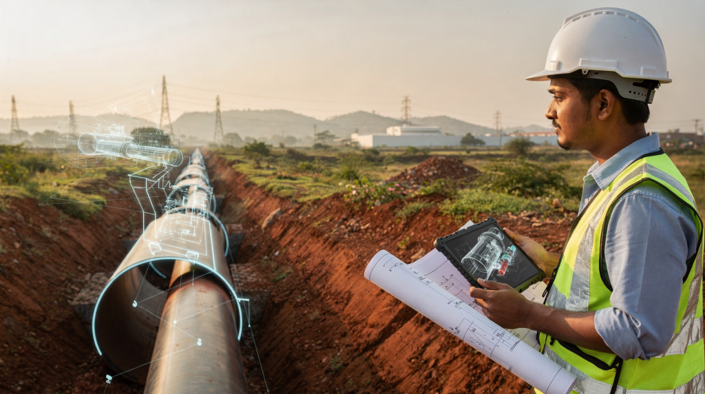
When I first started working with pipeline integrity in oil and gas, a “digital twin” meant a live model that could tell you exactly where a corrosion pit was growing and whether you had six months or six years before it became a problem. Today, the same thinking applies directly to the water, sewer, and gas networks that run through Indian residential townships. The difference is that instead of a 48‑inch crude oil trunkline, we are now talking about 150 mm DI water mains, HDPE sewer laterals, and MDPE gas lines running under footpaths and basement parking. The physics is simpler, but the coordination and long‑term ownership challenges are often messier.
A digital twin is not a one‑time 3D flythrough for a sales gallery. It is a continuously updated, data‑linked model of the actual underground network — geometry, material, condition, inspection history, and operational behaviour all in one place. That changes how we plan, verify, and maintain these lifelines over the 30‑ to 50‑year life of a township.
What a digital twin means in pipeline infrastructure
In plain terms, a digital twin is a virtual copy of a physical asset that stays connected to the real world through surveys, sensors, and inspection records. For a pipeline network, this means the model holds not just the route and diameter of every pipe, but also its material grade, joint type, bedding condition, invert level, valve and chamber locations, pressure regime, and every CCTV inspection clip or leak repair note ever recorded against it.
What makes it different from a conventional GIS layer or an as‑built drawing is the live link. When a sewer section is cleaned and re‑inspected, the twin updates. When a pressure logger shows a gradual drop in a water zone, the twin flags it. When a gas service line is relocated because of a driveway widening, the twin reflects the change. That continuity is what turns a static record into an operational tool — something a facility team can actually use to decide where to dig, what to reline, and when to replace.
Why digital twins matter in Indian residential developments
Most large Indian townships look impressive on paper, but the reality under the ground often tells a different story. I have walked sites where water, sewer, and gas lines cross each other at unplanned depths because the civil contractor and the MEP contractor worked from different versions of the same drawing. The result: a sewer line that sags because a stormwater drain was laid too close, or a gas line that gets nicked during a water main repair because nobody knew it was there.
A properly maintained digital twin removes that ambiguity. It gives every stakeholder — developer, consultant, municipal inspector, facility manager — the same view of the network. That shared picture helps in several practical ways:
- Clash detection before a single trench is cut. Overlay water, sewer, gas, electrical, and telecom routes on the same model and you see conflicts while they are still cheap to fix.
- Better coordination between services. In a typical Indian project, water supply hours are limited, sewer lines rely on gravity, and gas operates at low pressure (usually 21 mbar for PNG). A twin lets you check that the gas line is not trapped under a water chamber, that sewer gradients are not compromised by other crossings, and that valve pits remain accessible after landscaping.
- Faster fault isolation. When a pressure drop or a wet spot appears, the model helps narrow down the segment, saving hours of blind excavation.
- Predictive maintenance. Instead of waiting for a sewer choke or a water leak to become a complaint, the twin can rank assets by risk — age, material, soil corrosivity, past defect frequency — and schedule inspection before failure.
- Transparent handover. The residents’ welfare association or facility operator gets a living record, not a cupboard full of faded prints.
How a pipeline digital twin works
A useful twin is not a single software package; it is a combination of five layers that work together:
- Asset geometry: exact routes, diameters, materials, depths, fittings, chambers, valves, manholes, and service connection points. For sewer, this includes invert and soffit levels; for water, the pressure zone and hydraulic grade line.
- Context data: site topography, road alignments, building footprints, basement extents, retaining walls, and other utilities. This is what prevents a sewer line from being routed through a lift pit or a water main from clashing with a stormwater box culvert.
- Live or periodic data: pressure readings from water zones, flow meter totals, tank levels, gas pressure at district regulators, and — where installed — acoustic leak sensors or water quality monitors. Even a single pressure logger at the farthest end of a water network can tell you a lot about supply equity and hidden leaks.
- Inspection data: CCTV sewer surveys, leak detection reports, in‑line inspection results for metallic pipes, coating holiday tests, and maintenance work orders. Every defect gets pinned to a specific chainage and asset ID.
- Analytics layer: rules and models that flag anomalies — a sudden increase in night flow, a sewer segment that blocks twice a year, a gas service with higher than normal pressure drop — and rank assets for intervention.
In day‑to‑day terms, the twin answers three questions that every township operator needs to answer: Where exactly is the pipe? What condition is it in right now? And what is likely to fail next if we do nothing?
Main use cases in planning and inspection
1) Route planning and conflict checking
Before a single meter of pipe is laid, the digital twin lets you test proposed routes against foundations, basement ramps, retaining walls, and other utilities. I have seen a 200 mm sewer line clash with a pile cap that was missed on 2D drawings — caught in the model, it saved a costly redesign and a four‑week delay. For municipal approvals, a clash‑free coordinated services drawing backed by a model carries far more weight than a set of disjointed service plans.
2) Pressure and flow optimization
In Indian townships, water supply is rarely 24×7. Most projects operate on a timed schedule, filling overhead tanks from a ground sump. A twin that links the pump curve, tank levels, and network pressures can help balance zones so that the top‑floor flats get the same pressure as the ground‑floor ones, and it can pinpoint where a small leak is bleeding thousands of litres into the soil every day. For gas networks, the twin verifies that the pressure at the farthest apartment stays above the minimum required for the gas meter and appliances, even during peak cooking hours.
3) Sewer system inspection
Sewer networks are the most inspection‑dependent of all utilities. A digital twin becomes a living logbook: every CCTV survey clip is attached to the exact manhole‑to‑manhole segment, showing root intrusion, cracks, sags, or displaced joints. Over time, patterns emerge — a particular stretch that chokes every monsoon, or a joint that keeps opening because of soil movement. That intelligence lets the facility team plan relining or replacement before a complete blockage backs up into homes.
4) Corrosion and condition assessment
For metallic pipes — older galvanised iron water lines, ductile iron mains in aggressive soils, or steel gas risers — inspection data and corrosion rate models can estimate remaining wall thickness and remaining life. This is especially useful in coastal townships or areas with high groundwater salinity, where external corrosion can cut a pipe’s life by half. The twin highlights the 50‑metre segment that needs recoating or cathodic protection, rather than treating the whole network as equally risky.
5) Predictive maintenance
Instead of a fixed annual cleaning cycle, the twin helps schedule work based on actual condition. A sewer segment with no defects and good slope may need cleaning every two years; one with a known sag and recurring debris may need attention every quarter. For water networks, a zone with rising night flow gets a leak survey before the loss becomes visible on the surface. This shifts the maintenance team from firefighting to planned, budgeted work.
Digital twin vs traditional as-built drawing
| Aspect | Traditional drawings | Digital twin |
|---|---|---|
| Purpose | Static record of design or handover | Live operational model with updates |
| Utility conflicts | Often found late, during construction or after | Can be checked and resolved in planning |
| Inspection use | Limited linkage to field findings | Inspection data mapped to exact assets |
| Maintenance planning | Mostly reactive — fix after failure | Supports predictive planning |
| Operational visibility | Fragmented across teams and formats | Shared view across all stakeholders |
What data you need for a useful twin
A digital twin is only as good as the data fed into it. In Indian projects, the most common failure mode is a beautiful 3D model built on unverified survey data. That is worse than no model at all because it breeds false confidence. The essential dataset must include:
- Accurate topographic survey and underground utility survey (using GPR or trial pits, not just desk records)
- Pipe material, diameter, wall thickness, and joint type for every segment
- Depth of cover, invert and soffit levels for sewer lines, and hydraulic grade for water mains
- Valve, chamber, air valve, scour valve, and access point locations with unique IDs
- Slope and gradient confirmation for all gravity lines
- Pumping records, pressure logs, and flow meter data where available
- Inspection history: CCTV reports, leak survey findings, corrosion measurements, and defect logs
- Maintenance records: repairs, replacements, cleaning dates, and any changes made after handover
- Sensor data if the project has permanent monitoring — pressure transmitters, flow meters, or acoustic loggers
If any of these inputs are missing or outdated, the twin becomes a visualisation exercise, not an engineering tool. I always tell developers: start with a solid field‑verified base, even if it is simple, and add layers as the network matures.
Common mistakes to avoid
- Treating the twin as a presentation tool for management instead of an operations tool for the maintenance team.
- Building it once at design stage and never updating it after construction — the as‑built reality always differs from the design intent.
- Feeding in poor survey data and assuming the model is accurate. A 300 mm error in sewer invert can mean the difference between self‑cleansing velocity and a permanent choke point.
- Ignoring field verification after installation. Every pipe should be surveyed before backfilling, and those coordinates must update the model.
- Overloading the system with data that nobody uses. Start with the parameters that directly affect service reliability — pressure, flow, slope, defect history — and expand later.
- Forgetting that sewer and water networks need different performance checks. A water model focuses on pressure and leakage; a sewer model focuses on gradient, flow depth, and structural condition.
- Using the model without a clear maintenance workflow. The twin should generate work orders, not just pretty heat maps.
A practical workflow for township projects
Step 1: Build the base model. Start from approved service drawings, verified survey data, and site conditions. Include all known utilities, not just the ones you are designing.
Step 2: Validate in the field. During and after installation, check actual pipe locations, depths, chamber positions, and access points. Use as‑built survey data to correct the model — this is non‑negotiable.
Step 3: Add asset metadata. Attach material, diameter, wall thickness, installation date, contractor details, and pressure test or gravity test records to each asset.
Step 4: Connect inspection data. Link every CCTV survey, leak detection report, pressure test result, or corrosion measurement to the specific pipe segment or node.
Step 5: Define rules and alerts. Set thresholds for low pressure, abnormal night flow, recurring blockages, or rising defect counts. These become the triggers for preventive action.
Step 6: Update regularly. A twin that is not updated after a repair, a replacement, or an extension becomes a historical artefact within months. Make updating part of the standard operating procedure for the maintenance team.
What buyers and owners should ask in an Indian township
If you are evaluating a property — whether an apartment or a villa — the quality of the utility network will affect your daily life far more than the lobby finishes. Before signing, ask the developer or the facility manager these questions:
- Can you show me an updated utility layout with verified routes, not just the original design drawings?
- Is there a record of water pressure testing, sewer gradient testing, and gas tightness testing for the entire network?
- Do you maintain asset‑level maintenance and inspection history — when was each sewer line last cleaned, each valve exercised, each water zone checked for leaks?
- Are there known risk points, such as low‑pressure zones in upper floors, recurring sewer trouble spots, or gas lines that run under heavy traffic areas without adequate cover?
- Does the project use any form of digital mapping, monitoring, or sensor‑based leak detection for utility management?
- Who updates the utility records after handover to the residents’ association, and how often?
These questions cut through the glossy brochures and reveal whether the invisible infrastructure has been treated as an afterthought or as a long‑term asset.
When digital twins are worth the investment
A full digital twin is not necessary for every project. For a small standalone building with a single water connection and a short sewer line, a well‑maintained asset register and a set of marked‑up drawings may be enough. The twin becomes worth the investment when the network is large, complex, or carries high consequences of failure. That includes:
- Large residential townships with multiple water zones, booster pumps, and underground tanks
- Mixed‑use developments where commercial kitchens, healthcare facilities, or data centres share the same utility corridors
- Projects with multiple utility corridors stacked in narrow setbacks
- Sites where water supply is unreliable and every litre of leakage matters
- Systems where sewer access is difficult — deep manholes, constrained spaces — and reactive maintenance is expensive and disruptive
- Networks that need to be managed over decades, not just built and handed over
The cost of a digital twin should be weighed against the cost of one major sewer collapse under a finished road, one gas line strike during a water repair, or one year of undetected water loss. In most townships of 500 units or more, the twin pays for itself within the first few years of operation.
Checklist for better pipeline planning and inspection
- Confirm accurate survey and utility mapping before design starts — invest in GPR or trial pits if existing records are unreliable.
- Verify pipe sizes, slopes, and invert levels against hydraulic calculations and site conditions.
- Link every critical asset — valve, chamber, manhole, connection point — to a unique ID that stays with it for life.
- Keep inspection findings tied to location and date, not just filed in a folder.
- Update the model after every modification, repair, or extension — make it a mandatory step in the permit‑to‑work process.
- Use the twin for maintenance planning, not just design review. If the operations team never opens the model, it is not a twin — it is a decoration.
- Review problem zones regularly: the sewer segment that chokes every monsoon, the water zone with chronic low pressure, the gas service that shows a slow pressure decay.
- Keep the workflow simple enough that the facility supervisor can use it without a specialist consultant on speed dial.
Final takeaway
Digital twins bring the same rigour to township pipeline networks that industrial plants have used for years. They connect design intent, field reality, and operational performance in one place, so that decisions about maintenance, repair, and upgrade are based on evidence, not guesswork. For Indian residential projects, that means fewer surprises during construction, a cleaner handover to the owners’ association, and a network that stays reliable for decades — not just until the defects liability period expires.
FAQ
What is the main benefit of a digital twin for pipelines?
It gives engineers and facility managers a live, decision‑ready view of pipeline condition, layout, and risk. Instead of relying on static drawings that may be years out of date, the twin shows what is actually in the ground and what needs attention next.
Can digital twins help with sewer inspection?
Yes, and this is one of the most practical applications. Every CCTV inspection can be linked to the exact manhole‑to‑manhole segment, so recurring defects — root intrusion, sags, displaced joints — become visible as patterns. That helps prioritise relining or replacement before a complete blockage occurs.
Is a digital twin useful for water supply networks in India?
Absolutely. Even without 24×7 supply, a twin that integrates pressure loggers, tank levels, and pump run times can support leak detection, pressure management, and more equitable water distribution across a township. It turns intermittent supply data into actionable insight.
Do digital twins replace field inspection?
No. A digital twin improves the targeting and interpretation of field inspections, but it still depends on periodic physical verification — CCTV surveys, leak detection, valve exercising, and visual checks. The twin tells you where to look and what to look for; the field crew confirms the actual condition.
Are digital twins only for large projects?
They deliver the greatest value in larger, more complex township systems where utility coordination and long‑term maintenance are harder to manage. However, the principles — asset register, inspection linkage, regular updates — can be applied at any scale. A small project may not need a full 3D model, but it still benefits from a structured digital record of its underground assets.